|
1.
Flinders Ranges
Hema |
|
|
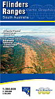
2.
Flinders Ranges
Cartographics; 1st edition.
Size 690mm x 1000mm folded to 140mm x 250mm
The front side covers the area from Yunta/Orroroo/ Wilmington northwards to Farina/ Mt Freeling/Arkaroola at 1:350,000 scale. It shows full road and public track network, National, Conservation and private parks, Heysen & Mawson Trails, all overlaying an attractive hill-shaded backdrop with extensive geographical feature names. The reverse side features expanded scale, topographic style maps over selected popuar areas. Wilpena Pound is covered at high detail 1:50,000 scale suitable for walkers and general tourist use in this popular area. The Quorn/ Pichi Richi/ Dutchmans Stern and Mount Brown area is covered by a 1:100,000 scale map as is the Flinders Ranges National Park. Vulkathuna-Gammon Ranges National Park and Arkaroola Protected Area are covered in a single 1:200,000 scale map. All these maps show road and track detail, contours & hill shading, walking trails, campgrounds, and significant features. Also includes are tables for fuel availability, distance chart and station stays & drives. |
|
|
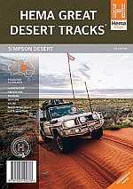
3.
Great Desert Tracks of Australia Simpson Desert Sheet - 4WD
Hema
The Great Desert Tracks Simpson Desert Sheet is a double-sided map, with an overview-centric scale of 1:1.1Million on one side and a highly detailed scale of 1:500,000 on the other. The mapping has been fully updated, with GPS surveying and field-checking of roads and tracks done by the Hema Map Patrol. The landscape is more realistic and visually imaginative thanks to the addition of relief shading and elevation tinting, all presented on tough and durable waterproof and tear-proof paper. Also included is fuel and provision availability, permit and contact details, and details and map references for interesting spots. .
- Scales of 1:500,000 and 1:1.1Million on each respective side.
- Field-checked by the Hema Map Patrol |
|
|
4.
Adelaide Hills and Barossa
Cartographics: 1:150 000 Size: 685 x 1000mm. A touring map of the Adelaide Hills and Barossa region Featuring the Barossa wine region; Mount Crawford; Hahndorf, Stirling and Bridgewater. |
|
|
5.
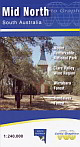
Mid North South Australia
Cartographics: Scale: 1:240 000 size: 690 x 1000mm. Covering the Mid North in South Australia from Kapunda across to Burra in the East up to Port Pirie and Port Augusta extending to Whyalla in the west. |
|
|
6.
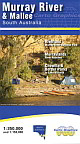
Murray River & Mallee
Cartographics: 1:150 000 Size: 690 x 1000mm. Covers the river all the way from Lake Alexandrina to Lake Victoria. The reverse has 9 inset maps including 'Chowilla & Border Parks' and the 'Riverland'. |
|
|
7.
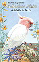
Nullarbor Plain
Cartographics: Scale: 1:2 250 000 Size: 620 x 500mm A double sided map of the Nullarbor Plain, covering both the Eyre Peninsula and the Nullarbor Plain, from Adelaide to Perth including tourist information and illustrations of native flora and fauna. |
|
|
8.
South East South Australia
Cartographics: 1: 350 000 Size: 690 x 1000mm Covering the South East of South Australia from Strathalbyn & Milang to Mount Gambier & Casterton, this map is the perfect companion whatever the reason. |
|
|
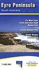
9.
Eyre Peninsula
Cartographics: 1:600 000 Size: 1000 x 680mm Covering the Eyre Peninsula in South Australia from Port Wakefield to Ceduna |
|
|
| |
Your Basket
0 items in basket
|
|

